


Drone surveying has revolutionized the way professionals collect spatial data, offering a faster, cheaper, and safer approach than traditional methods. But raw drone data has its constraints. Even the most advanced UAVs can produce visually compelling but spatially inaccurate maps and models without proper ground-based reference markers.
That’s where Ground Control Points (GCPs) come in. These physical markers, located at known geographic coordinates, connect your aerial data to the real world. The result is survey-grade accuracy that stands up to professional scrutiny.
Here’s what they do and what you get when you use them properly.
1. Dramatically Improved Positional Accuracy
The first advantage is accuracy. A drone’s onboard GPS is usually consumer or survey-grade at best, usually with 1-3 meters of horizontal accuracy. That margin of error cannot be tolerated for construction staking, cadastral mapping or volumetric calculations.
When processed correctly with photogrammetry software, GCPs can reduce that error to the centimeter level. When you link your aerial imagery to precisely surveyed coordinates, every pixel in your orthomosaic and every point in your point cloud is anchored to a verified real-world location.
Why This Matters in Practice
- Accurate elevation data is essential for construction teams to plan earthworks and drainage
- Surveyors need legally defensible boundary information
- Engineers require accurate surface models in order to evaluate structures
- Agricultural analysts need accurate elevation differences for water-flow modeling.
None of these use cases produces trustworthy outputs without spatial anchoring.
2. Reliable Elevation and Vertical Data
Horizontal accuracy gets the lion’s share of attention but vertical accuracy is as important and more difficult to obtain without reference markers.
Elevation models derived from drones can have vertical errors of 1–5 meters based on GPS alone. Ground control points are critical for providing the vertical reference information photogrammetry software needs to produce accurate Digital Elevation Models (DEMs) and Digital Surface Models (DSMs), particularly when they are distributed at different heights across the survey site.
- Volume calculations for stockpiles, excavations and dump sites
- Flood risk modeling: small elevation differences, big consequences
- Road and infrastructure design that needs accurate grade and slope data
- Estimates for cut and fill in civil engineering projects
A 20cm vertical error in a stockpile calculation can mean a big financial difference over large volumes.
3. Strengthened Data Validation Through Check Points
Smart surveyors don’t just use GCPs for processing. They reserve some of their markers as checkpoints. These are independent reference locations not used in the photogrammetric processing, only used to validate output accuracy after the fact.
If your processed model closely matches the checkpoint coordinates, your data has passed quality control. If it doesn’t, you know before the deliverable gets to the client
This workflow:
- Catches processing errors early
- Provides a documented accuracy report for clients and regulators
- Strengthens professional credibility and legal defensibility
- Reduces costly re-flights caused by undetected errors
Checkpoints turn accuracy from an assumption into a verified, reportable metric.
4. Consistent Results Across Multiple Flights
Large projects often involve multiple flight missions on different days, with different light, and sometimes different pilots. When these datasets are stitched together without spatial reference markers, there will be drift and misalignment between flight zones.
Ground Control Points provide a common coordinate framework for all flights. All datasets use the same fixed ground points, so the areas overlap perfectly, and the final combined model is seamless and continuous in elevation.
This is especially valuable for:
- Progress monitoring on construction sites over weeks or months
- Large-scale corridor surveys for pipelines or powerlines
- Agricultural field mapping across multiple growing seasons
5. Compliance with Industry and Legal Standards
There are accuracy thresholds in many industries (contractual or regulatory) that drone data must meet. Infrastructure, mining, and land development projects often require survey-grade deliverables to document positional accuracy within defined tolerances.
You can show your data meets these standards by using georeferenced markers and reporting their residual errors. It provides clients, regulators, and auditors with a transparent and verifiable accuracy trail from raw flight data to the final deliverable.
Getting the Most from Your GCPs
Placement and measurement quality determine how much value your reference markers actually deliver. Keep these principles in mind:
- Distribute markers evenly across the survey area, including the corners and edges
- Avoid clustering all points in one zone; spread covers the whole project footprint
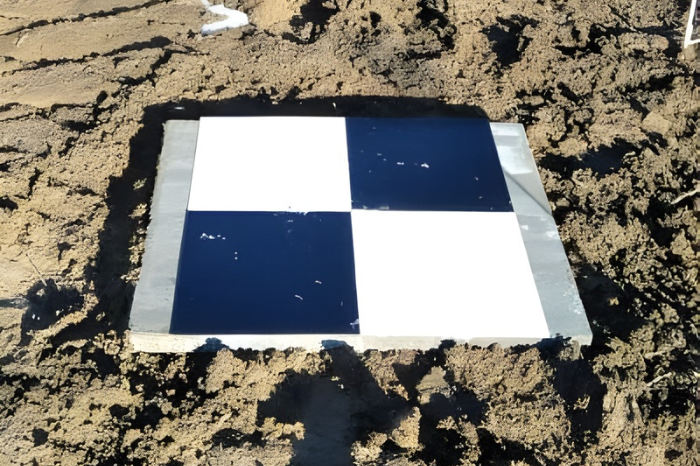
- Use high-contrast targets that are clearly visible in aerial imagery
- Measure with RTK or a total station for sub-centimeter coordinate accuracy
- Aim for a minimum of 5 GCPs for most projects, with additional checkpoints for validation
The markers themselves cost almost nothing. The accuracy they deliver is worth everything.
Conclusion
The accuracy of drone surveys is only as good as the data they collect, and that data is only as good as its spatial foundations. Ground control points close the gap from stunning aerial imagery to survey-grade accuracy that professionals, regulators, and clients can trust.
Whether you’re mapping a construction site, modeling a mine or doing precision agriculture analysis, anchoring your flights with properly placed and measured reference markers is not optional. It’s the difference between data that looks good and data that is good.


Leave a Reply