
Satellite Communication utilization has become wide spread and ubiquitous. Most of us are touched by satellite communication in more ways than we realize. It is used across the globe for diverse applications like Television, Broadcasting, Digital Satellite News Gathering, Security, Defense and VSAT to exploit unique capabilities in terms of coverage and outreach. This technology has matured substantially over past three decades and is being used on commercial basis for a large number of applications.
According to UNOOSA – United Nations Office for Outer Space Affairs, a total of 9602 objects have been launched into Outer Space till 2020. and 574 Objects have been launched in the Year 2020 till date.
Advantages and Disadvantages of Satellite Communication
- The coverage area of a satellite greatly exceeds that of a terrestrial system.
- Transmission cost of a satellite is independent of the distance from the center of the coverage area.
- Satellite to Satellite communication is very precise.
- Higher Bandwidths are available for use.
- Satellite bandwidth is gradually becoming used up.
- There is a larger propagation delay in satellite communication than in terrestrial communication.
Future Trends in Satellite Communication
The overall demand for satellite data will grow annually at 30% between now and 2025. The global market for new launch technology for small satellites will be worth £25 billion over the next 20 years.
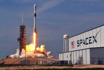
 SpaceX: Starlink is the name of a satellite network that the private spaceflight company SpaceX is developing to provide low-cost internet to remote locations. While SpaceX eventually hopes to have as many as 12,000 satellites in this so-called megaconstellation, the size and scale of the project have flustered astronomers and amateur skywatchers, who fear that the bright, orbiting objects will interfere with observations of the universe.
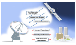
 Ground station network as a service for next-generation satellites - As the space sector keeps rapidly expanding, businesses coming up with the best technologies to meet its new requirements are set to thrive. Ground stations network enabling real-time, cost-effective, and easy access to micro/nano-satellite data, these ground stations makes it suitable small satellite operators market . Historically, the ground segment of space missions has mostly been designed, deployed and operated by mission operators themselves. Smaller satellites in comparison imply less stringent requirements and amounts of data to be transmitted per satellite yet require flexible operations and low latency.
 Anti-satellite weapons (ASAT) are space weapons designed to incapacitate or destroy satellites for strategic military purposes. United States, Russia, China, and India have demonstrated this capability successfully. These nations have shot down their own satellites to demonstrate their ASAT capabilities in a show of force. Several nations possess operational ASAT systems. Although no ASAT system has yet been utilized in warfare. The future roles include a defensive measure against an adversary's space-based nuclear weapons, a force multiplier for a nuclear first strike, a countermeasure against an adversary's anti-ballistic missile defense (ABM), an asymmetric counter to a technologically superior adversary, and a counter-value weapon.
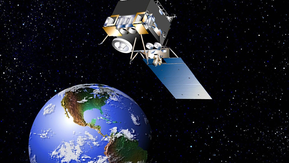
 Wideband Global SATCOM - The U.S. Air Force launched a Wideband Global Satcom satellite aboard a United Launch Alliance Delta 4 medium rocket from Cape Canaveral, Florida. This is the 10th satellite of the WGS constellation that provides broadband communications for the U.S. military and allies. Boeing was selected as the WGS manufacturer in 2001. The first satellite was launched in 2007. Boeing's ninth Wideband Global SATCOM satellite launched into orbit and will provide the US and six allied nations with increased communications capabilities to prevent, protect against and respond to attacks.
- Higher Employment Opportunities - There will be 100,000 space sector-related jobs available just in the UK by 2030.
 Satellite and Autonomous Vehicles - Terrestrial WiFi and cellular networks support will be required to allow fully autonomous vehicles to navigate city streets and highways. Satellites will play an equally important role in delivering secure software updates and other critical information, such as mapping data, needed for the connected car. Connected and autonomous vehicles are going to forever change the way we move people and products. The connected environment will also change the way auto manufacturers address vehicle operational improvements, which are increasingly software-driven. The savings available from cutting even a single recall visit over the lifespan of a vehicle provide a compelling argument for enabling connectivity to vehicles.
 Future Satellites for Oceans cover over 70% of the Earth’s surface. They feed us, regulate our climate and are a road that connects us all. Satellite and airborne technology offer enhanced possibilities to monitor with detailed granularity their health. Future research where satellites are going to be a major driver includes - Plastic Trash Tracking, Shallow Waters - Remote sensing quantifying the coral reef crisis, Monitoring Ocean Health - Plankton and Acidification
- 370 small satellites are expected to be deployed into low- or medium-orbit for communication services and Earth observation imagery which would represent a yearly market of $1.6 billion on average over the next decade.
 Satellite - Deforestation Monitoring - . The European Parliament’s resolution of 4 April 2017 noted that 40% of global deforestation is caused by clearing vegetation to make way for palm oil plantations. The activity is particularly common in Indonesia and Malaysia where palm oil is produced for use in the manufacture of chocolates, industrial bakery products, cosmetics and biofuels. The resolution pointed out that a monitoring service was required and called for “concrete regulatory measures” to ensure that, in the future, no supply chains linked to the EU were connected to deforestation. Helping companies with their ‘No Deforestation’ commitment, Starling – which has been developed jointly by Airbus, non-profit organisation The Forest Trust (TFT) and Netherlands-based company SarVision – is designed to provide that much-needed earth deforestation monitoring service.
 Insurers Turn to Satellite Imagery for Damage Assessment - The vast possibilities of how insurance companies can utilize satellite imagery are only continuing to grow. These platform unlocks the value of large amounts of geospatial imagery using deep learning and rigorous data science. Through its state-of-the-art analytics technologies, satellite data management companies will be able to provide insurers with actionable information so they can better understand the risk and extent of the damage.
 NASA - ISRO's Synthetic Aperture Radar - Using advanced radar imaging that will provide an unprecedented, detailed view of Earth, the NASA-ISRO Synthetic Aperture Radar, or NISAR, satellite is designed to observe and take measurements of some of the planet's most complex processes. These include ecosystem disturbances, ice-sheet collapse, and natural hazards such as earthquakes, tsunamis, volcanoes and landslides. Data collected from NISAR will reveal information about the evolution and state of Earth's crust, help scientists better understand our planet's processes and changing climate, and aid future resource and hazard management. The mission is a partnership between NASA and the Indian Space Research Organization.
 Transmitting Data from Observation Satellites - Several observation satellites have been developed to continuously monitor the Earth for probing the environment and forecasting weather. These satellites possess space radio stations on board using which they collect data and transmit it back to the Earth through feeder links.
- Data Transmission Using Deep Space Probes - The power, volume, and mass of the onboard equipment in deep space probes are strictly limited and so the transmit power and antenna diameter is also restricted. Thus, a high power transmitter and huge receiving antenna are generally equipped in the ground station to compensate for the onboard limitations.
 Communication within the Clusters of Satellites - The functions that are generally carried out by one huge satellite can be allocated to several interlinked and co-located smaller satellites. Each satellite may be assigned with a different function, but on the whole this cluster would act as one huge satellite. Maneuvering synchronization and cooperative control are crucial for maintaining safety boundaries within the colocation slots. LEO satellites monitoring and control systems are controlled using connectivity extended by GEO satellites.
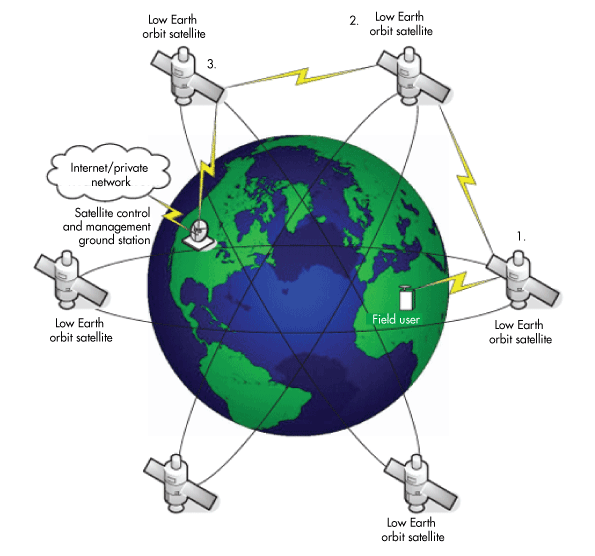
- LEO satellites - Low earth orbit (LEO) satellites have been hailed as the next big thing in non-terrestrial communications, with the potential to boost data backhaul for operators, bring broadband connectivity to underserved regions, and further enable cloud and edge-based services. The key advantage of LEO satellites over legacy geostationary earth orbit (GEO) satellite services is the much lower altitude. This not only slashes the cost of launching and maintaining the constellation, but also improves downlink speeds and latency due to a much-reduced data round trip.
 Internet Broadband Service to Space Planes and Aircrafts - High speed access to internet is possible in several aircrafts today. Similarly, Unattended Aerial Vehicles (UAV), and high altitude platforms are also promising contenders for the optical communication system applications.


 SpaceX: Starlink is the name of a
  Ground station network as a service for next-generation satellites -
 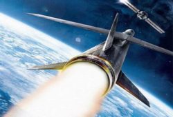 Anti-satellite weapons
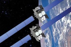 Wideband Global SATCOM - The U.S. Air Force launched a Wideband Global Satcom satellite aboard a United Launch Alliance Delta 4 medium rocket from Cape Canaveral, Florida. This is the 10th satellite of the WGS constellation that provides broadband communications for the U.S. military and allies. Boeing was selected as the WGS manufacturer in 2001. The first satellite was launched in 2007. Boeing's ninth Wideband Global SATCOM satellite launched into orbit and will provide the US and six allied nations with increased communications capabilities to prevent, protect against and respond to attacks.
 Satellite and
 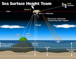 Future Satellites for Oceans cover over 70% of the Earth’s surface. They feed us, regulate our climate and are a road that connects us all. Satellite and airborne technology offer enhanced possibilities to monitor with detailed granularity their health. Future research where satellites are going to be a major driver includes - Plastic Trash Tracking, Shallow Waters - Remote sensing quantifying the coral reef crisis, Monitoring Ocean Health - Plankton and Acidification
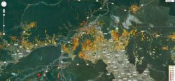 Satellite - Deforestation Monitoring - . The European Parliament’s resolution of 4 April 2017 noted that 40% of global deforestation is caused by clearing vegetation to make way for palm oil plantations. The activity is particularly common in Indonesia and Malaysia where palm oil is produced for use in the manufacture of chocolates, industrial bakery products, cosmetics and biofuels. The resolution pointed out that a monitoring service was required and called for “concrete regulatory measures” to ensure that, in the future, no supply chains linked to the EU were connected to deforestation. Helping companies with their ‘No Deforestation’ commitment, Starling – which has been developed jointly by Airbus, non-profit organisation
  Insurers Turn to Satellite Imagery for Damage Assessment - The vast possibilities of how insurance companies can utilize satellite imagery are only continuing to grow. These platform unlocks the value of large amounts of geospatial imagery using deep learning and rigorous data science. Through its state-of-the-art analytics technologies, satellite data management companies will be able to provide insurers with actionable information so they can better understand the risk and extent of the damage.
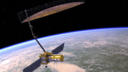 NASA - ISRO's Synthetic Aperture Radar - Using advanced radar imaging that will provide an unprecedented, detailed view of Earth, the NASA-ISRO Synthetic Aperture Radar, or NISAR, satellite is designed to observe and take measurements of some of the planet's most complex processes. These include ecosystem disturbances, ice-sheet collapse, and natural hazards such as earthquakes, tsunamis, volcanoes and landslides. Data collected from NISAR will reveal information about the evolution and state of Earth's crust, help scientists better understand our planet's processes and changing climate, and aid future resource and hazard management. The mission is a partnership between NASA and the Indian Space Research Organization.
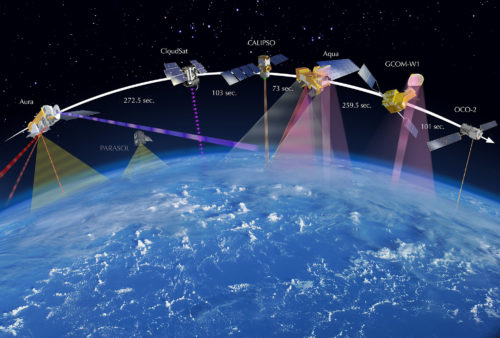 Transmitting Data from Observation Satellites - Several observation satellites have been developed to continuously monitor the Earth for probing the environment and forecasting weather. These satellites possess space radio stations on board using which they collect data and transmit it back to the Earth through feeder links.
 Communication within the Clusters of Satellites - The functions that are generally carried out by one huge satellite can be allocated to several interlinked and co-located smaller satellites. Each satellite may be assigned with a different function, but on the whole this cluster would act as one huge satellite. Maneuvering synchronization and cooperative control are crucial for maintaining safety boundaries within the colocation slots. LEO satellites monitoring and control systems are controlled using connectivity extended by GEO satellites.
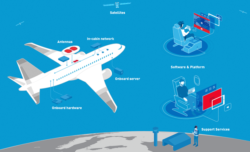 Internet Broadband Service to Space Planes and Aircrafts - High speed access to internet is possible in several aircrafts today. Similarly, Unattended Aerial Vehicles (UAV), and high altitude platforms are also promising contenders for the optical communication system applications.







Leave a Reply